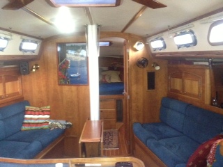
(This post brought to you by Rick. Note the jaunty blue color….)
This post will be a two parter – first the “why did it take too long,” and then some details about the trip to Charleston.
Part 1
The plan was for MT, Skip and me to sail overnight down the Bay to Norfolk. We would drop off MT in Norfolk, then travel three days down the ICW to Beaufort, NC to avoid sailing around Cape Hatteras, which is notorious for bad weather. We would pick up Ryan and Sarah in Beaufort, then sail offshore to Charleston, which would theoretically take about 36 hours. So, weather permitting, we’d be in Charleston after about a week. Weather permitting.
I was confident that the weather was going to get us at some point on the way to Charleston – I just didn’t think it would be day one. Skip, MT and I left Annapolis Sunday morning, with a forecast of 15-20 from the northeast, higher down the Bay, but also supposedly laying down as the afternoon and evening went on. We rolled out the jib at 1AH (for the non-sailors, that is the channel marker leaving Annapolis that designates where to enter the Chesapeake Bay), and were off to the races. Except the wind was more like east, and built to more like 25-30. We rolled in some jib, and kept going, waiting for the forecasted decrease in the wind. It did lay down for a bit, but a couple of miles past Solomons I started seeing 27, then 28 and so on, until we were getting 33s. With a forecast that hadn’t been right yet, I decided we’d rather not cross the Potomac in that much breeze after dark, and turned back to Solomons.
An hour or so later we tied up at Calvert Marina, evaluating potential ways to divide up the rest of the trip to Norfolk. After discussing one or two options, the conclusion was a short day Monday to Fishing Creek, and an o-dark-thirty departure for Norfolk Tuesday, so that we could get past the Gilmerton Bridge in the afternoon (more on that in Part 2).
But that meant we’d already lost a day, and therefore also lost the crew ready to join in Beaufort (turns out it didn’t matter – with the weather on the day we’d have left we wouldn’t have gone offshore anyway). And, since I hadn’t taken Calypso offshore before, I wasn’t ready to go overnight with just two of us. That meant that we’d have to stay in the ICW, and get outside when weather and possible hops between inlets and anchorages permitted.
This is where the logistics get important. Unlike the Chesapeake, there often isn’t a marina or anchorage around every corner. And since one of these guys might be running after dark,

you can’t anchor in the channel, which is often the only place deep enough to anchor. Or just pick your spot and pull over for the night, like this.

Okay, the chart didn’t show the marina

but it was interesting watching the chart plotter show us sailing through the marsh, then dry land.
Plus bridges often only open on the hour or half hour. Plus there can be current (Calypso travels under power at about 7 miles per hour under ideal conditions – our actual speed varied from 5 to over 9, depending on conditions). The veterans know this, but you sit down with the charts, the bridge schedules and list of places to stop, and lay out each day’s travel, with options for weather. For example, we could have gone “outside” from Beaufort to Wrightsville Beach, which could have saved us a day. But the day we’d have made that passage the wind was blowing from the southwest. And you can guess what direction we were going.
The net result is that some days we could only make 40 miles instead of our theoretical 70 or 80 mile range. We didn’t just stop at Coinjock at 2 in the afternoon because we wanted to see the big sport fisherman. We just couldn’t make the next stopping point before dark.
Part 2
Now for some highlights and observations about the trip. Eva already posted about our encounter with the submarine, but I’m posting another photo.

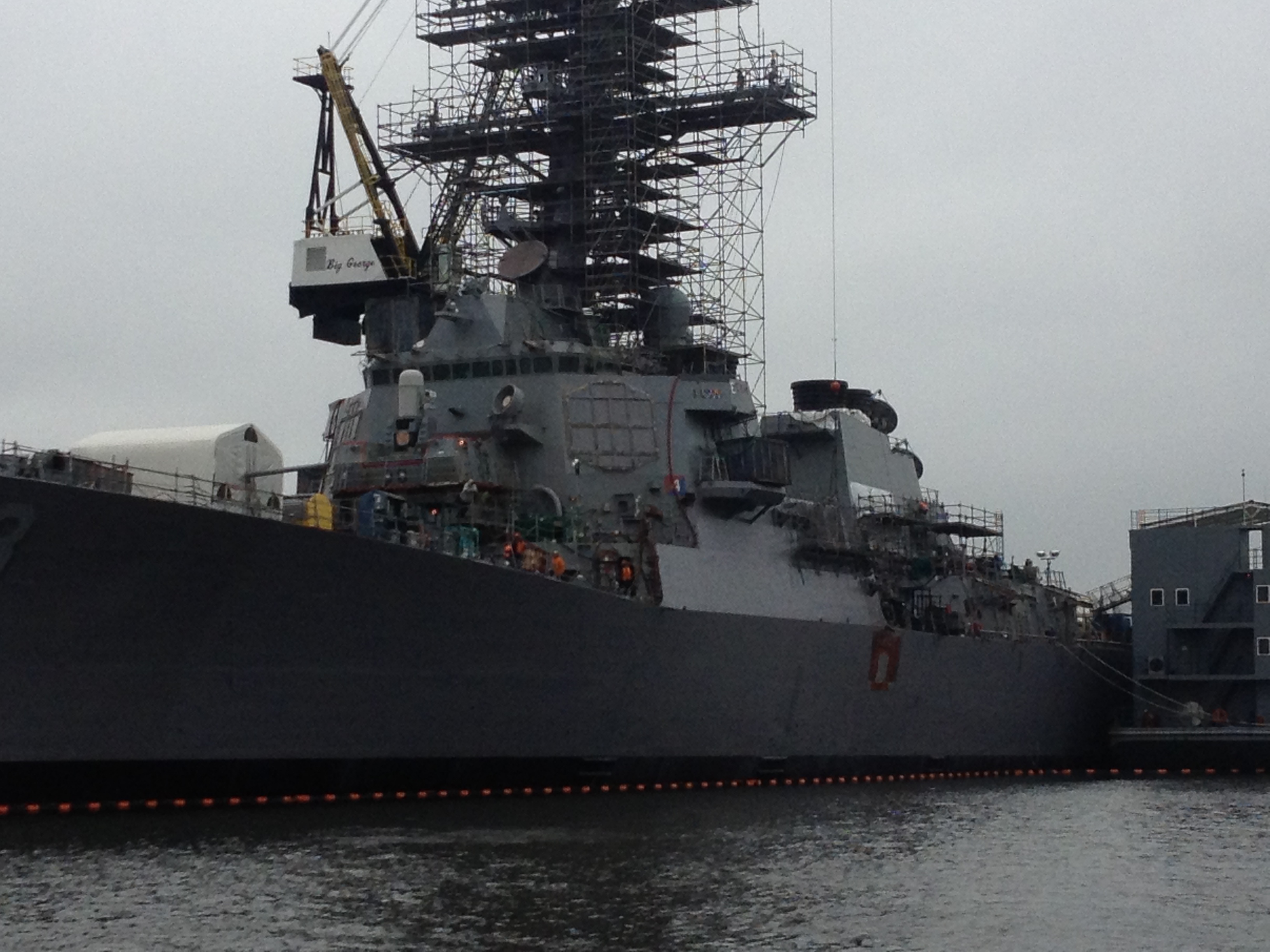
Watching it blow by us, about 50 yards away, as we were approaching Norfolk harbor, was amazing. The armada of naval vessels moored in Norfolk is equally impressive, including the USS Laboon, where our niece Rachel is stationed as a newly commissioned ensign.
Past Norfolk is logistics problem #1 – the Gilmerton Bridge. The bridge serves a major road, and so it doesn’t open at all between 6:30-9:30 a.m., or 3:30-6:30 p.m. during the week. Traveling at Calypso speed you either make the 3:30 bridge, or leave a marina in Norfolk at 5:30 a.m. the next day. Otherwise you spend two days getting the 40 miles rom Norfolk to Coinjock. See part 1 – we decided that Fishing Creek in the dark was better than Norfolk in the dark. We dropped MT at Tidewater Marina right on schedule – early even. Like we’d make the 2:30 bridge. Then I got my next lesson in losing control of your schedule – the railroad bridge that is “usually open” was down. As time ticked down on making the 3:30 Gilmerton Bridge opening, it finally opened. A few miles further along we locked through at Great Bridge then stopped for the night. For a buck a foot, a hot shower at Atlantic Yacht Basin beat out fighting for space at the free dock!
Eva has mentioned some of our stops – after Great Bridge we stopped in Coinjock, NC, anchored in the Pungo River in North Carolina

picked up marinas in Morehead City (see if you can pick out which one of the boats in the photo is not like the others . . . )

Hampstead, North Carolina (our detour on to dry land from Part 1), Southport, NC

and the Waccamaw River. We anchored in a creek in the low county of South Carolina (Price Creek, if you are looking at your chart),

and finally tied up at the Charleston City Marina

Nice neighbors, huh?
We didn’t stop in many of the typical southbound spots (or if we did, not for very long), so my photo gallery is mostly scenery, which is varied, but not too exciting. The waterway is everything from industrial Norfolk area to the cypress swamps in the Chesapeake-Albemarle Canal in Virginia

and the Waccamaw River in South Carolina

to the coastal pine forests of North Carolina

to the marshy low country of South Carolina, like our last anchorage.
So that’s it. Because someone out there wants the details, 585 miles, 10 1/2 days, 79 engine hours, 2-1/2 days of pure sailing, 11 bridges and one lock.
So that’s how we got to Charleston. Next stop, Vero Beach . . .